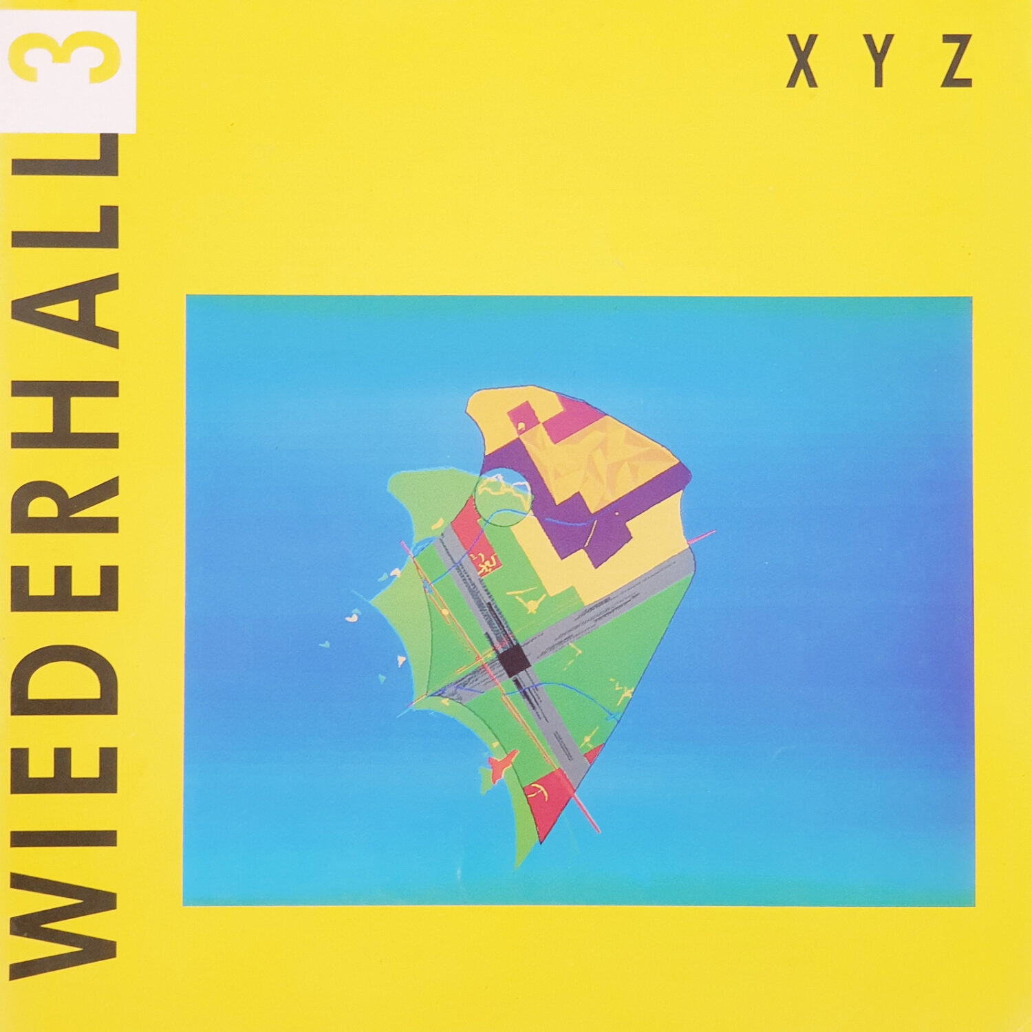
The XYZ series includes three design exercises: planning (Polder XYZ), architecture (Conservatory XYZ) and material (Lego XYZ). 1] The XYZ system of coordinates materializes as the basic relational framework for further signification and complexity. 2] The XYZ system of coordinates attaches the projects to their context creating a self-imposed fixed center point related to the site. 3] The XYZ system of coordinates defines the exact position of the points, the planes and the volumes in a continuous space 4] The center point of the XYZ system of coordinates is a floating point in space, either vaporous, liquid or solid, from which the design develops in all six axial directions. 5] The six directions describe the project as dynamic volumes/planes on a continuous scale, above ground and underground are equivalent, in front of and behind are equally important, left and right decentralized and a-symmetric. 6] The major events which are set apart from the materialized XYZ system of coordinates are mathematically described as elements whirling in space, following their own self-sufficient concentric rules. 7] The events are sublimated into tangible elements, mind-elements or function-elements and form-elements, or any possible mutual superposition. 8] The major events are never experienced simultaneously, they represent the general relativity of the system. 9] The XYZ series propagates intuitive scientific style, testing permanently ex1sting images on recent social and technical developments. 10] The designs of the XYZ series are scientifically international, geologically national or even local, and intuitively personal. Markerwaard XYZ should be regarded as a pleading tor stimulating design from the very start of the making of a polder. In this initial stage every decision concerning management basically is a decision subject to design. For this reason it is of utmost importance to calling highly qualitied designers into the process of developing the new polder. If not, the appearance and the viability of the polder will be left in the hands of subordinated employees. In that case the polder is doomed to be yet another monument of structural impotence. The polder is subject to a series of major management/design decisions: first there is the dike-trace, not only the basic envelope of the gained land, but moreover the fringe of the created lakes. The course oft the dike is design priority number 1. The early polders in the swampy low-lands of Holland simply follow the outlines of an existing lake. The Haarlemmermeer is a splendid example of polder-design: the entire dike dividing and connecting new and existing land has become a most industrious environment. In the case of the IJsselmeerpolders the task was different. Piece by piece the new land was taken from the harnessed inland sea. The first achievements were rounded oft forms plummily attached to the mainland. The next two polders were conceived as an island divided from the mainland, thus creating recreative border-lakes. The Markerwaard XYZ continues this attitude, with a strong emphasis on the autonomous beauty of the stylish course of the dikes. Their graciously curved lines honors the force of the winds blowing through the ages to form the stretched bay-areas. Having finished the dikes the land falls dry below sea-level. This waste-land needs to be clearly structured for future developments. Here comes in the relational grid based on optimal commercial dimensions. This grid is an overlay pattern to let through the geological qualities of the underlying land. Coincidentally the dimensions of the grid,2 x2 km, correspond to those chosen in the Haarlemmermeer. This polder is the only Dutch polder where the grid is of an eminent straightforwardness. A drive through the polder makes sure that large dimensions, emptiness and absence of detail can offer great visual qualities. The Markerwaard XYZ will be related to the mainland by a set of crossing highways. Both the architecture of the bridges and the junctions and the landscaping of the highways determine the quality and hospitality of the new land. Driving the highway crossing the Haarlemmermeer is an impressive experience of an unmatched spaciousness created by the 8-lane road. The bridge-restaurant and the show-piece of the take-off and landing at Amsterdam International Airport add an expanded sense of enlarged space. In the Markerwaard XYZ the crossing of the polder will be experienced as one long-stretched instant. The polder will be occupied by the pioneers who will establish new settlements in the virginal plain. It is a designer’s opportunity to catch the spirit of the pioneers and escort their expanding nature. First of all, pioneers must not be saddled up with a nostalgic definition of a city as has happened at Almere. In the Haarlemmermeer something like a city has not emerged, due to urbans centers in the immediate surroundings. However, it is a challenge worth considering a settlement in the middle of the Randstad that will display the qualities of an extensified suburbia.

Time-based planning
The polder offers challenging opportunities to create new ways for spending free-time. This is the perfect place for the ultimate designer’s goal: creating the splendid prison, a touch of paradise. It belongs to the task of the government to consider thoroughly the architectural and environmental possibilities of this series of major management and design-decisions, in order to manufacture a 1% Netherlands which will dignifiedly face the ages. One possible set of clearly defined solutions is offered in this project: Markerwaard XYZ. When you are positioned o the tenth floor of an office-building at the crossing of Sixth North Street and Second East Avenue your coordinates in the Markerwaard XYZ are X6/Y2/Z10. The Markerwaard XYZ will be planned within the limits of a rigid time-table. After respectively 5 years (T5), 15 years (T5) and 30 years (30) the qualities of the strategies become tangible.
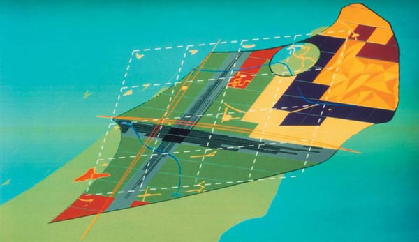
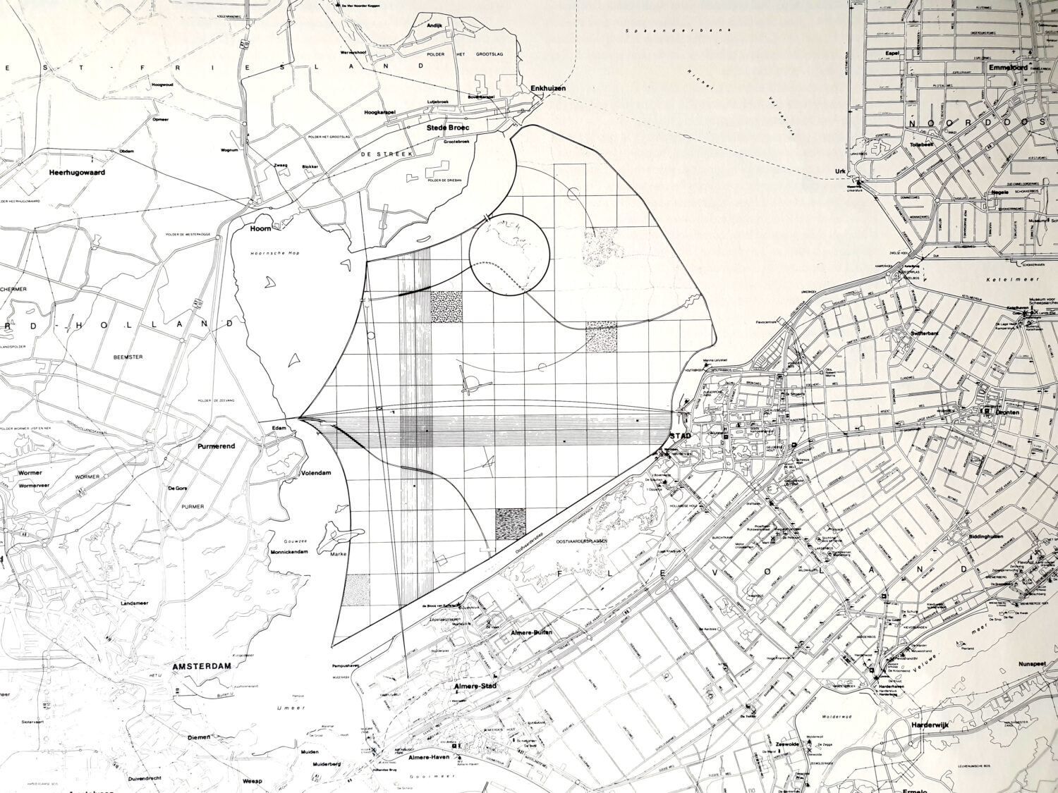
T5 |The dikes surround an area which is substantially larger than in the current government’s proposal (6000 ha). The overall length of the dike however is equally long. The proposed shape shortens land to land connections and at the same time widens the created lakes. The stylish shapes reminds of sails bulging in the western winds. The bays seem caused by natural tides creating endless stretched beaches. The island of Marken is disconnected from the mainland and resolutely pressed into the new polder like a wedge. Being a historic landmark it functions here as the stimulator for new developments. Marken gives its name to the new polder. A respectable nature reserve of prime ecological Importance is created in its most defensive shape: the closed circle. It represents the other side of the world. This Worldsea will be of international significance especially for birds, amphibians and swamp vegetation.
T15 | The structural module of 2 km by 2 km is based on well-defined dimensions of the agricultural industries. The highways are designed to experience a stretched and slowed-down sense of time. Having passed the bridges the two lanes slowly separate to meet again 30 km later at the other end of the polder. This 15-minutes drive feels like one long stretched instant. The driver does not face any oncoming cars. The north-south and east-west highways are set apart from the axes of the city to avoid noise nuisance.
T30 | Independent of the structure of the polder a 5 km stimulation grid is superimposed on the Markerwaard XYZ. The areas touched by the grid points are awarded with recreational significance. By gathering separate activities into the strategy of the stimulation grid the new polder is incessantly attacked by the terror of leisure. Geological particularities lead to a variety of agricultural industries. They become visible through the grating of the 2 km grid and form planes of homogenous serenity. Right across this functional and thematical blueprint the XYZ-axes for urban development are superimposed. The crossing of the X-axis and the Y-axis determines the city center. Here the power of the Z-axis becomes tangible, it describes the high rise office and apartment buildings. Lines both enclose and cross the planes. The traces of the dikes surround the polder accompanied by the extensive beaches. The canals cut through the grid and give way to recreational yachting. Harbors are planned at the four ends of the canals. Highways span from coast to coast, both north-south and east-west. Main avenue and main street intersect downtown. The stimulation grid consists of 16 grid points. They create guaranteed opportunities and add recreational values to the awaiting wasteland. The center of this point strategy is the international airport. All points generate a number of joyful events and dramatic imagery. They promote scientific entertainment, experimental farming or simply the beauty of an abandoned wasteland.

